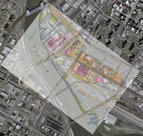
Bronx map overlay
1942 vs. Today
click on image for larger version….
An interesting composition sent to me by Anton Torstensson of Sweden, combining the 1942 map with a satellite image of the same area.
I am surprised how well it lines up with all the major landmarks. Visible in the centre is the Bronx Terminal and to the upper center is the Harlem Transfer. A similar combination can be found here.
Thanks for the contribution Anton.
Tim
About the Author:
I'm your host, Tim Warris, a product developer in Port Dover, Ontario. Since March of 2007 I have been documenting the construction of the former CNJ Bronx Terminal in HO scale. For my day job, I design track building tools for Fast Tracks, a small company I own and operate. Fast Tracks makes it fast and easy to hand lay your own trackwork. Stop by our website to learn more!
Posted by: Tim | 04-25-2007 | 08:04 PM
Posted in: Latest Posts | Prototype Information (the real stuff)

